Vineyard management is constantly evolving based on new findings of growing grapes, managing vineyard resources, and with the development of new tools and technologies. A driver of those changes in the last couple of years has been the intensive development of Precision Viticulture (although the PV concept has started to developed already in the late 1990s). Especially in the context of economic viability and climate change, the viticulture industry is forced to adopt more sustainable practices.
In Precision Viticulture, all is about geo-positioning or geolocation to know where exactly the vineyard, and everything within the vineyard, is located. This enables the assessment of spatial variation within the vineyard or vineyard block, which winegrowers can use to make better decisions. There are two essential tools of Precision Viticulture – the Global Navigation Satellite System (GNSS) and Geographical Information System (GIS). And where in all this is GPS?
Well, let’s before diving deeply into how winegrowers can use GPS for improved and more sustainable vineyard management, first clear up some terms often used in the context of PV, such as geo-positioning, GNSS, GIS, etc.
Geospatial technologies used in viticulture
Geo-positioning technology is a technology that enables the identification of an object based on three dimensions – longitude, latitude, and elevation – with the help of satellites. More or less precise determination of an object’s geo-positioning in time anywhere on Earth is today globally available and possible due to Global Navigation Satellite System (GNSS). Thus GNSS is a term describing any satellite constellation that provides positioning, navigation, and timing services anywhere on Earth.
Several different GNSS have been developed and launched, and the most know one is GPS, which stands for the Global Positioning System, developed and operated by the government of the United States. Other such systems are Galileo (developed and launched by the EU), GLONASS (by Russia), and BeiDou (by China, where the last one is not in complete globally covering operational state at the moment of writing.) Actually, even India and Japan have their own regionally available systems.
In the beginning, GPS was available only for military purposes, and only later it became available for civilian use. Nowadays, it’s available on any phone and other devices we use daily. While we often like to say that we are turning on a GPS on our phone, most of the newer smartphones actually use multiple GNSS systems to derive a location in an as precise manner as possible – meaning that at the same time as GPS, our phone may also be using Galileo and GLONASS.
In viticulture, GPS and other GNSS are being used for different vineyard management activities such as vineyard design, vineyard mapping, soil sampling, canopy, and vigor monitoring, variable rate applications, yield mapping, and similar – therefore, mainly for tasks that required high precision location. Since GNSS as such are enabling only the three-dimensional positioning in time, its real usability (for viticulture) comes when combined with other geospatial technologies such as Geographic Information System (GIS) and Remote Sensing (RS).
GIS is a Geographic Information Systems used for gathering, managing, and analyzing data gathered with the help of usage of GNSS and other sources. It enables the analysis of spatial locations and organizes layers of information into visual maps. Thus, it reveals more profound insights into data, such as patterns and relationships, to help make smarter decisions. Put fairly simply, the GIS software converts field data collected with GNSS into use-friendly maps.
RS – Remote Sensing is the process of detecting and monitoring the physical characteristics of an area by measuring its reflected and emitted radiation at a distance. For this, special cameras are used to collect remotely sensed images, which help decision-makers “sense” and “see” things that sometimes can not even be seen when standing on the ground.
Examples of how winegrowers can use GPS for improved and more sustainable vineyard management
The suitable site and variety selection
With the help of Geographic Information Systems, Remote Sensing, and Global Positioning Systems, winegrowers can select suitable vine grape site(s) based on several different parameters such as: topographic (elevation, slope, aspect), soil (soil texture, soil pH, and soil drainage), climate variables (daily maximum and minimum temperatures, precipitation, extreme minimum winter temperature, and growing degree days), the estimated probability of disease, traditional crop production, and land zoning.
Several known winegrowing regions have maps with suitable vine grape sites and varieties selection, available for winegrowers, that were made by institutes and governments. However, not all wine suitable sites have that, and in this case, winegrowers can either ask for help the vineyard specialists or do research on their own, based on freely available data and reports on the web. One such analysis was made for the country of Nepal, where researchers tried to find the best suitable sites for grape production by analyzing climate, soil, and topographic conditions from freely available data. Based on several GPS and RS data, a vine grape suitability map for Nepal was made in the GIS, based on ranks and weights of different vineyard suitability parameters. Since variation in soil and topography impacts the variation of vineyard performance, data gathered for site selection can also be used to design new or to re-develop older vineyards.
In the context of site selection, similar parameters can be used to select the most suitable grape variety and its rootstock for the observed area. With climate changes and warming of the planet, this will be of increased importance, as vines that are currently thriving well in some environments soon won’t be the most suitable anymore.
Planting vines and vineyard management
In correlation with site selection and vineyard design, vines can be planted with the help of GNSS and some additional global positioning solutions to centimeter accuracy. This enables precise location information of each vine, which can be further used for different vineyard management activities, especially the ones that require precise location, such as yield monitoring and machine harvesting, soil sampling, variable-rate spraying, etc.
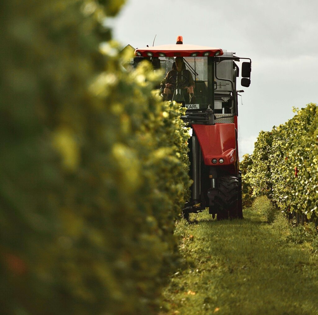
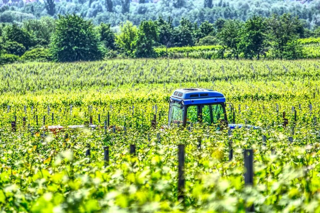
Tracking vineyard work – lowering costs and carbon footprint
A lot of work in the vineyard is done by tractors or other machinery that, as we know, are not environmentally friendly due to the internal combustion engines that they use. Namely, studies found that fuel production and combustion by using machinery in the vineyard (especially in the planting phase) is one of the vineyard activities that produce the most Co2e emissions in the wine production cycle. On the other hand, fuel costs money; therefore, the more driving is needed, the more costly vineyard management is. With GPS, the vineyard fleet can be tracked, while GIS enables the display of individual routes on a map. Winegrowers can then analyze the tracks and make better decisions of certain vineyard activities to reduce fuel usage and costs and save time. GPS tracking of the fleet is also useful to prevent machinery theft, while in-time monitoring increases the safety of workers.
Taking soil samples and precise fertilization
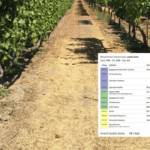
Soil sampling is the first step in generating field-specific information to make fertilization decisions. GPS is used in several ways, 1) to create a map (in GIS) of soil variability in the vineyard, whether this is done with the help of soil electric conductivity sensor or any other spatial variability sensing technology, and 2) to navigate winegrower year after year to different locations within a vineyard to collect site-specific soil samples. Having accurate data on vineyard soil variability enables variable-rate fertilization.
Vineyard Scouting
Scouting fosters vineyard inspections and data collection processes. By using GPS in combination with vineyard management software, such as eVineyard, winegrowers can capture the location and photos of observed pests or diseases on a vine, or collect other information such as, for example, note down a broken post that needs to be repaired. Scouting with GPS coordinates is also useful for tracking phenology and yield.
Other vineyard management activities
Many other Precision Viticulture technologies, and consequently improved and more sustainable vineyard management activities, are possible due to GPS and GNSS. For example, ground-based remote sensing system was developed to provide a high-resolution screening of the canopy for collecting information on the height and texture of the vines along the row, coupled with one of the GNSS systems for geo-referencing. Such a ground-based remote sensing system enables canopy and vigor monitoring, and due to the GPS, a map of the canopy can be displayed in software with GIS capabilities. The same goes for yield mapping: without the GNSS, the location of the information collected mapping would not be possible. Those maps can be further used by machinery software to enable selective spraying or fertilization based on location and set parameters. Selective management of vineyards lowers costs and minimizes the environmental impact, and thus contributes to more sustainable vineyard management.
Conclusion
The above examples show that precision viticulture would not be possible without GNSS – precise determination of an object’s geo-positioning in time anywhere on Earth and GIS that provides analysis and display of layers of information on visual maps. The most known and used GNSS is for sure GPS, however, also other GNSS exist, out of which Galileo is the newest and currently offers the most precise positioning for civilian users. In the last years, we saw many practical examples of Galileo GNSS use, developed by the EU. eVineyard tracking works with GPS as well as Galileo to help winegrowers improve their vineyard management and become more sustainable.
Sources and Further reading:
- Kuka, Ymer & Ameti, Perparim & Bandrova, Temenoujka. (2019). GIS/GPS solutions as efficient tools for sustainable management of vineyards in Kosovo. Geodesy and cartography. 45. 28-36. 10.3846/gac.2019.7083.
- Austin R., Gatiboni L., Havlin J. (2020). Soil Sampling Strategies for Site-Specific Field Management. Soil Facts. N.C. Cooperative Extension, Publication date: Aug. 10, 2020, AG-439-36 (online) https://content.ces.ncsu.edu/soil-sampling-strategies-for-site-specific-field-management
- Fraigneau C. (2009). Precision Viticulture. Tools to measure and manage vineyard variability. SupAgro Montpellier and University of Aberdeen
- Fairlie K. et al. (2011). Spatially Smart Wine – Testing Geospatial Technologies for Sustainable Wine Production. International Federation of Surveyors
- Vigorito, Angelo. (2010). GIS and Vineyard Management. 10.13140/RG.2.1.1068.4567.
- Acharya, Tri & Yang, Intae. (2015). Vineyard suitability analysis of Nepal. International Journal of Environmental Sciences. 6. 13. 10.6088/ijes.6002.